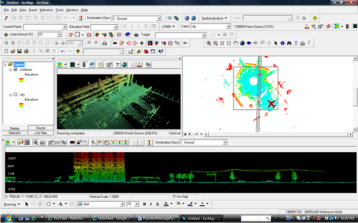
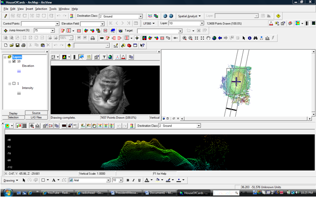
LiDAR technology was used to capture data for the image visualization in Radiohead's music video titled, "House of Cards". The resulting point cloud was manipulated to produce an awesome music video. Now that's Uber Cool! The band has also made the data available for its fans. I've converted the CSV files to LAS format and am playing around with some animation schemes. I'll post updates on my progress on this page. In the meantime, enjoy the music videos compliments of Radiohead and scroll down to see screenshots of lead singer Thom Yorke and the cul de sac data in LP360, the LiDAR Extension for ArcGIS, in an ESRI ArcView MXD.
MXD Screen shot of House of Cards Culdesac LiDAR data in LP360 for ArcGIS
MXD Screen shot of Radiohead lead singer, Thom Yorke, from House of Cards LiDAR data in LP360 for ArcGIS